


About us
National Informatics Centre (NIC) is a premiere S&T; institution of the Government of India, established in 1976, for providing e-Government/e-Governance Solutions adopting best practices, integrated services and global solutions in Government Sector. In 1975, the Government of India strategically decided to take effective steps for the development of information systems and utilization of information resources and also for introducing computer based decision support system (informatics-led development) in government ministries and departments to facilitate planning and programme implementation to further the growth of economic and social development. Following this,the Central Government nucleated a high priority plan project “National Informatics Centre (NIC)” in 1976, and later on with the financial assistance of the United Nations Development Programme (UNDP) to the tune of US$4.4 million. NIC has played an important role of an…
Events
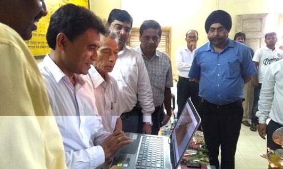
Launch of Online Payment of Registration and other Fees using...
Online Payment of Registration and other Fees using eGRAS Launched on 1st August, 2019 by Shri N.C. Debbarma, Hon’ble Minister…
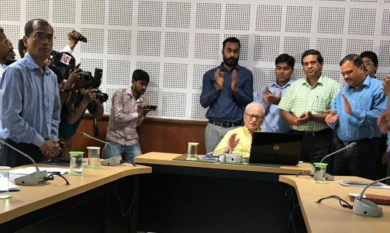
Launch of “Professions Tax Web Portal”
Launch of “Professions Tax Web Portal” by the Hon’ble Deputy Chief Minister, Govt. of Tripura The “Professions Tax Web Portal”…
Awards

Tripura receives eWorld 2011 Awards Awards
Tripura has been conferred with the prestigious eWorld 2011 Awards award by the egov digital elearnin @health for the year 2011. The award was given in…

Tripura receives CSI Nihilent Awards
Tripura has been conferred with the prestigious CSI Nihilent award by the CSI for the year 2009. The award was…
Photo Gallery
National Informatics Centre, Tripura State Unit
Block 4, 3rd Floor, New Secretariat, Khejurbagan
Agartala, Tripura 799010
Phone: 0381 – 2414053